Mineral
Exploration.
|
From Raw Streams to
GIS-Ready Insights.
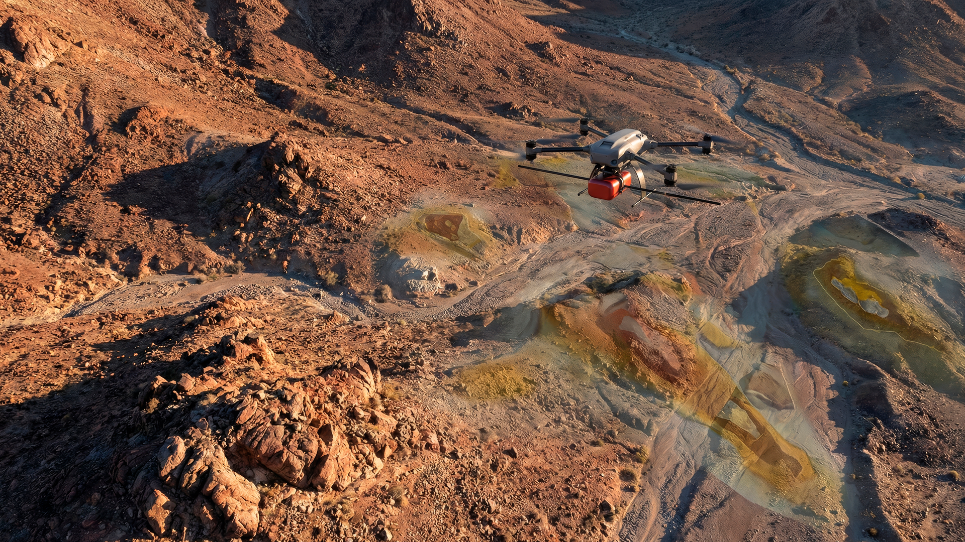
01 Acquire
CAPTURE REALITY: Multi-sensor capture with INS + RTK precision. Thermal, magnetic, and visual streams are time-aligned and geolocated for fusion.
02 Normalize
STRUCTURE THE CHAOS: Raw data streams are georeferenced and tiled into standards-friendly grids—ready for fast GIS querying and cloud workflows (COG / STAC).
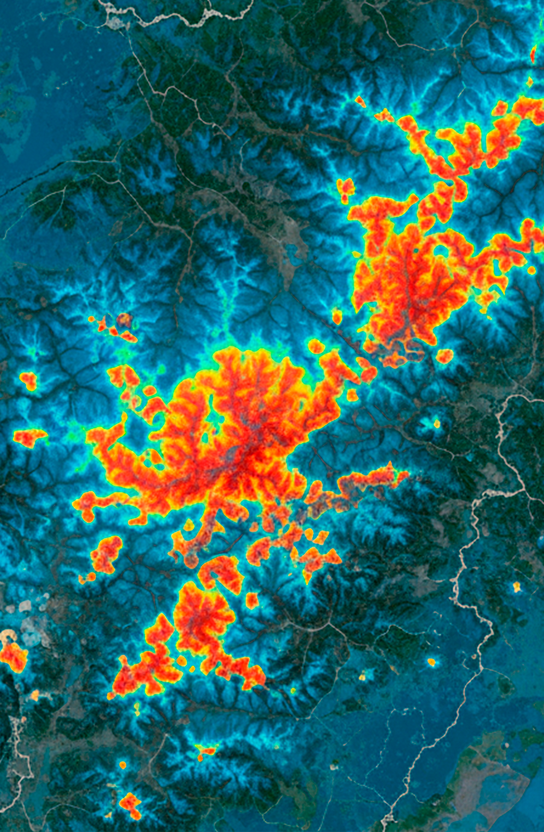
03 Fuse & Score
FIND THE SIGNAL: The Scout Engine cross-correlates multi-physics signals (magnetic + thermal + visual) to rank points of interest and surface high-confidence evidence—reducing false positives through measurable thresholds.
Scientific Foundations
Our methodology follows established practice and open standards from NASA (Remote Sensing), USGS (Aeromagnetics), and ESA/Copernicus (Change Detection).
Reports
Anomaly &
Evidence Layers
Georeferenced rasters and vector candidates generated from thermal, magnetic, and visual spectrums.
COG + STAC catalog
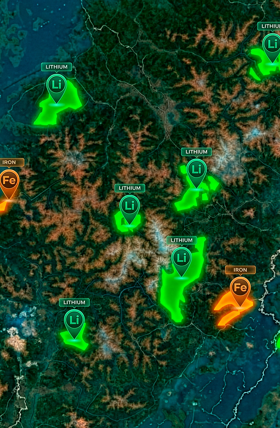
Ranked POIs
Points of interest with explainable supporting signals and confidence scores, reducing manual false positives.
GeoJSON / Gepackage
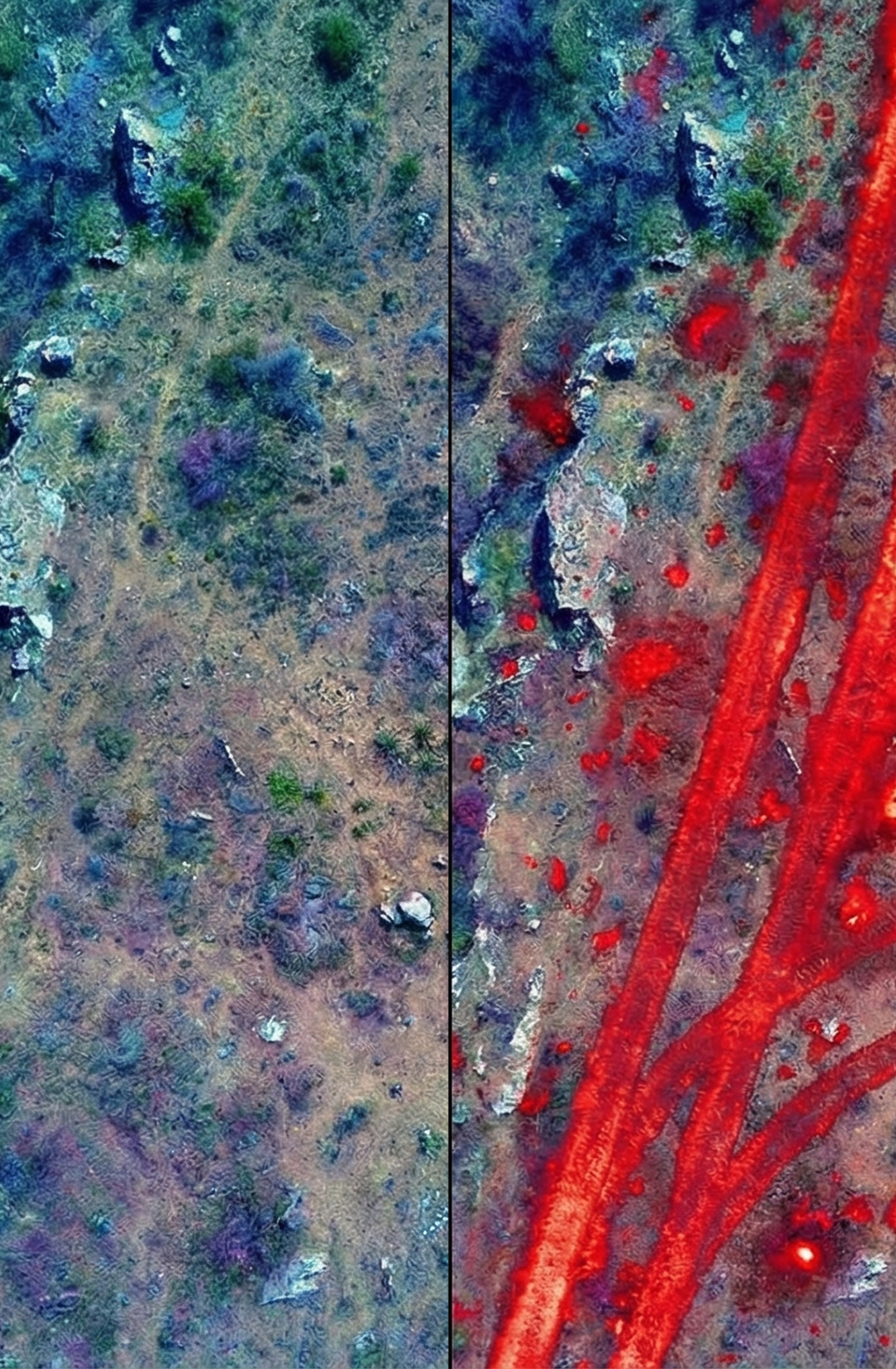
Temporal Change
(Spotter)
Automated differencing for ground motion, vegetation encroachment, and infrastructure activity between flight cycles.
Confidence + Explainability
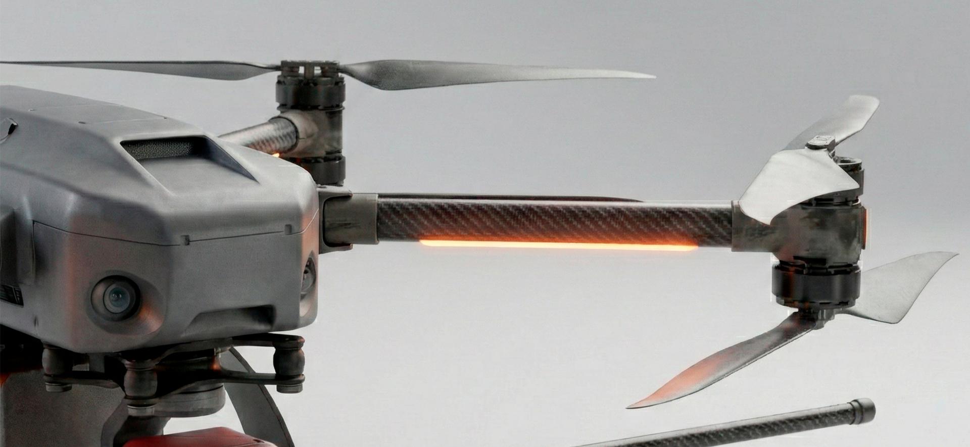
Precision Acquisition.
Modular Design.
Reliable analysis starts with perfect synchronization. Our modular onboard unit integrates:
Precision Timing001
Tight time-sync across sensors using PPS and hardware triggers.
Robust Logging002
High-speed NVMe storage with integrity checks for corruption-resistant pipelines.
Unified Output003
Time-aligned sensor streams (magnetic + spectral + thermal + imagery + nav) are normalized into a common grid and fused into confidence-weighted GIS outputs.
Build with us.
(through joint R&D.).
We collaborate with industrial and research partners to accelerate our core roadmap: multi-sensor fusion, change detection, and GIS-ready evidence layers—with clear deliverables and a validation plan.
Scoping & Alignment
Define the use case, AOI, constraints, success criteria, and available data/sensors.
Data & Integration
Connect data sources (sensor streams or existing datasets), normalize to GIS-ready layers, and produce initial evidence outputs.
Validation & Roadmap
Agree a verification approach (field checks / re-observation), iterate thresholds/fusion logic, and deliver an integration or joint R&D roadmap.
Request a Scoping Call
with our Technical Team
Whether you're looking for a pilot, a strategic partnership, or a joint R&D collaboration, we'll respond with a suggested workflow and next steps.